This article contains advertising. Our booking links are routed through a partner that adds commission tracking automatically, so if you book through one we earn a commission from the provider, at no extra cost to you. It never affects what we recommend. Affiliate disclosure
Stand on the viewing platform of Elephant Mountain at dusk and look the other way from Taipei 101 for a moment. Behind you, the hill you have just climbed rolls on into forest; to the north, the volcanic cones of Yangmingshan rise above the city haze; to the east and south, ridge after ridge of green runs off towards the coast and the central mountains. That is the secret of hiking in Taipei: the mountains start where the MRT ends. You can leave a hotel in the middle of a city of millions after breakfast, be on a forest trail within half an hour, stand on a steaming volcano or a golden grassland by lunchtime, and be soaking in a hot spring before dinner — all on public transport, and for the price of a coffee.
This guide is the overview: the best city hikes you can reach by metro, the volcanic peaks and grasslands of Yangmingshan, the coastal ridges and gold-mining hills of the north-east, the waterfall trails along the Pingxi railway, the beaches of the north coast, hot springs for tired legs, riverside cycling, and everything practical — when to go, what it costs, how to stay safe in the heat and the rain, and which famous “outdoor” trips we think are not worth the effort. Prices and details were checked in October 2026; treat them as the right order of magnitude and check before you set out.
Hiking in Taipei at a glance
| The short version | |
|---|---|
| Best city hike | Elephant Mountain for the view; the Four Beasts ridge for a longer walk; Jinmian Mountain for a scramble |
| Best mountain day | Yangmingshan National Park: Qixing Mountain, Taipei’s highest peak, plus the Qingtiangang grassland |
| Best train-and-trail day | The Pingxi Line: the Sandiaoling waterfall trail, Houtong and Shifen |
| Best coastal walks | Teapot Mountain above Jinguashi; the Caoling Historic Trail in silver-grass season |
| Best season | October to December, then March and April; summer is for dawn starts only |
| Getting there | MRT, city buses and local trains, all on one EasyCard |
| Cost | Trails are free; you pay only for transport, the odd gondola ride and your post-hike bath |
What things cost
| Item | Typical cost (September 2026) |
|---|---|
| MRT ride to a city trailhead | Roughly NT$20–40 with an EasyCard |
| City bus, including the buses up to Yangmingshan | From NT$15 per fare section |
| Local train to Ruifang, the Pingxi Line or Fulong | Tap your EasyCard; fares rose in 2025, so check the machine |
| Maokong Gondola | Check the current fare on the Maokong Gondola’s own site before you budget |
| 716 north coast tourist shuttle | NT$15 per section, NT$90 end to end |
| Trails, national parks and most viewpoints | Free |
| Public hot spring after a hike | From free foot baths to around NT$250 for an outdoor public bath; hotel day passes cost more |
| Taxi back from a trailhead | Usually NT$200–500 to the nearest MRT station |
Why Taipei is such a good hiking city
Taipei sits in a basin, and the basin is ringed by mountains. To the north is the Datun volcano group, now Yangmingshan National Park, with fumaroles still steaming on its flanks. To the east and south-east are the steep, forested hills of Neihu, Nangang and Xinyi, the foothills of the ranges that run down the spine of the island. To the south is Maokong’s tea country, and beyond the basin’s north-eastern rim the land falls away to a dramatic coast of headlands, old mining towns and beaches. Very few capital cities have this much wild ground so close to the centre.
Taiwan has made it easy to use. Many trails near the city are built as stone or timber staircases with handrails and signposts; the city government has laid out a network of “mountain-friendly trails” starting close to MRT stations and bus stops; and the public transport that gets you there runs on one card. The flip side is that Taiwanese hiking is mostly up: steps, steps and more steps, in heat and humidity that make a 300-metre hill feel like a proper mountain. Do not judge a Taipei trail by its height.
The best hikes in the city
These are the walks you can do in a morning or an afternoon with nothing more than an MRT ride. They are ordered roughly from easiest to hardest.
Elephant Mountain
The most walked tourist trail in Taiwan, and for good reason. From Xiangshan station at the end of the Red Line, a steep stone staircase climbs through the forest to a series of platforms and boulders looking straight at Taipei 101 and the Xinyi skyline — the classic view of the city. It is short, crowded at sunset, and genuinely steep for twenty minutes or so. Our Elephant Mountain guide covers the route, the best viewpoints and when to go.
Good for: first-timers, sunset and night photography, a short walk on your first evening.
The Four Beasts
Elephant Mountain is one of four small peaks in the hills behind Xinyi known as the Four Beasts — Tiger, Leopard, Lion and Elephant — and the paths that link them make one of the best half-day walks in the city. Mostly paved or stepped, it runs through forest, past temples and small shrines and along ridges with views of the skyline from angles most visitors never see. You can do it in about three hours end to end, drop off the ridge at several points, and finish at Elephant Mountain’s viewpoint for sunset. It offers the best reward for the least effort of any trail in Taipei.
Good for: a longer city walk without a bus ride; seeing the skyline without the Elephant Mountain crowds.
Our Four Beasts hike guide has the full route from Houshanpi, which way to walk it, timings for sunset and how to extend it onto the higher Nangang ridge.
Jiantan Mountain
Above Jiantan station on the Red Line, the small forested ridge of Jiantan Mountain has one of the city’s favourite viewing platforms, looking down over the red roof of the Grand Hotel and across the Keelung River to the airport and Taipei 101 in the distance. It is a short, stepped climb from the streets near the station — easily combined with the National Palace Museum in the morning or Shilin Night Market in the evening.
Good for: a quick view in the north of the city, and a legs-stretcher before the night market.
The Tianmu Trail
At the top of Zhongshan North Road, the Tianmu Trail follows an old Japanese-era water pipe up about 1,300 steps into the forest, then levels out on a shaded path to the edge of Yangmingshan. It is steep, green and full of Formosan macaques — do not feed them, and keep food out of sight. Allow an hour and a half to two hours for the out-and-back. Our Tianmu guide has the details, including the buses to the trailhead.
Good for: a proper workout in the forest, and a brunch in Tianmu afterwards.
Jinmian Mountain
In Neihu, the bare-rock summit of Jinmian Mountain is the most adventurous short hike in the city. Stone steps give way to scrambling over pale rock with rope handrails, and Scissors Rock, the viewpoint at the end of the climb, looks over Songshan Airport and the city; the true summit lies a few hundred metres farther east. It is about an hour up from near Xihu station on the Brown Line. Avoid it after rain, when the rock is slippery. Our Neihu guide covers the hike along with the rest of the district.
Good for: hikers who want a bit of scrambling, and plane-spotting from above.
Maokong’s tea trails
South of the city, the Maokong Gondola rises from Taipei Zoo over the forest to the tea-growing hills of Maokong, where paths wander between tea terraces, teahouses and temples. You can ride up and walk down, or link the trails to Zhinan Temple on the way. The walking is gentle by Taipei standards, and ending a walk with a pot of local oolong on a teahouse terrace is one of the city’s great pleasures.
Good for: an easy afternoon in the hills, tea and a sunset view back over the city.
The Taipei Grand Trail
For committed walkers, the Taipei Grand Trail is the city government’s long-distance route through the hills around the basin: about 92 kilometres in seven mountain sections, from Guandu MRT station in the north-west, over Yangmingshan, along the ridges of Neihu and Nangang, and round to Maokong in the south, with an eighth, riverside section that brings the full route to about 130 kilometres. Each section is a full day or less, most start and end near public transport, and locals collect the sections one weekend at a time. You need decent fitness, a navigation app and an early start, but no special gear.
Good for: repeat visitors and anyone staying long enough to walk a section a week.
Yangmingshan: volcanoes on the city’s doorstep
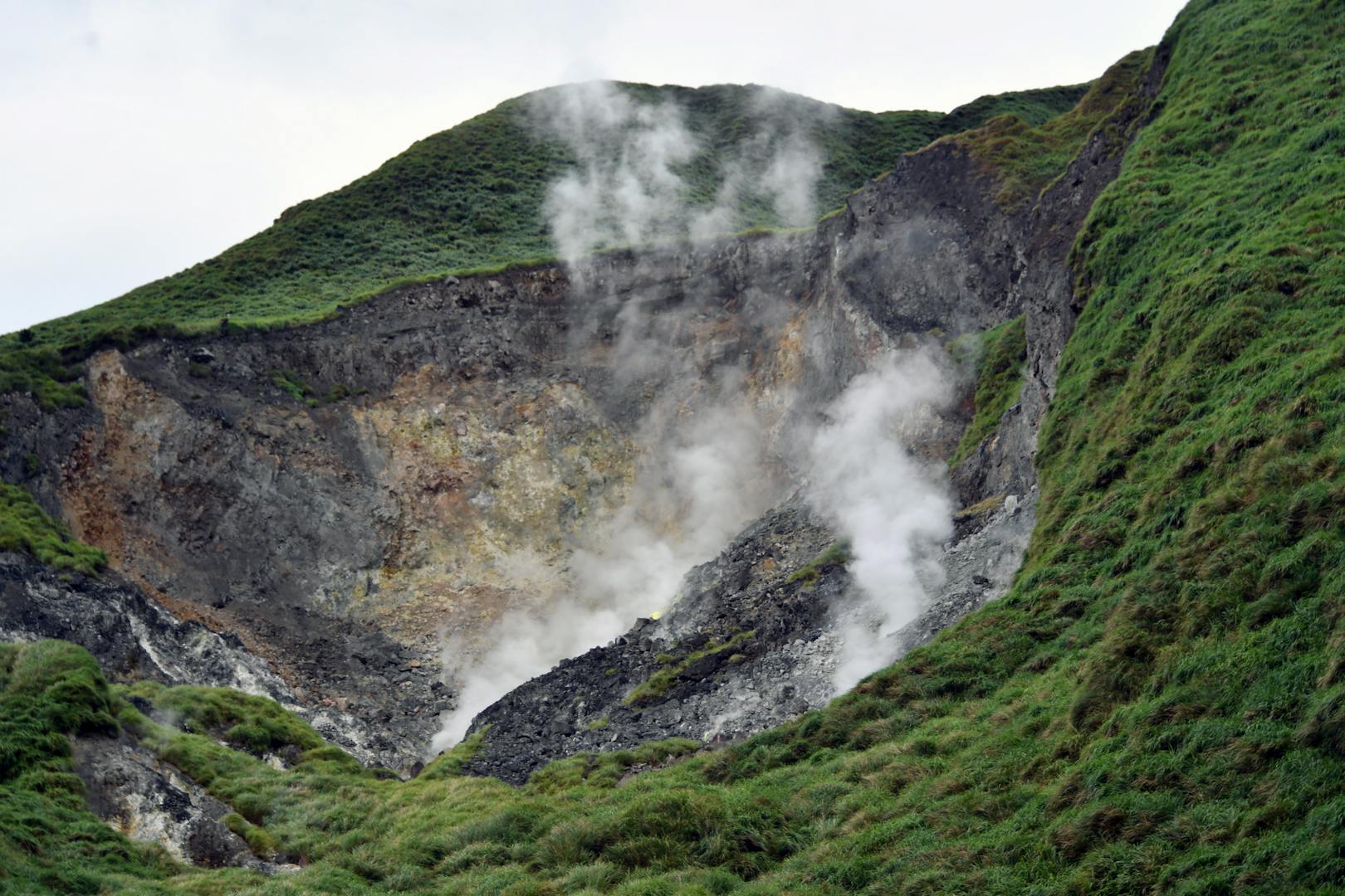
Yangmingshan National Park covers the dormant volcanoes on Taipei’s northern edge, with sulphur vents and hot springs, grasslands, forest, flower fields and mountain trails. It is also cooler than the basin — often five to ten degrees cooler at the top — and frequently wrapped in cloud, so bring a layer even in summer and check the forecast before you go.
Getting there is easy. Bus R5 (紅5) runs from Jiantan or Shilin station on the Red Line up to the Yangmingshan bus terminal, and bus 260 comes up from the Taipei Main Station area. From the terminal, the 108 loop bus links the main sights and trailheads inside the park, including Zhuzihu, Xiaoyoukeng and Qingtiangang. Our guides to Yangmingshan National Park and to a Yangmingshan day trip cover the park in full, and the park’s own official website posts trail closures after storms.
Qixing Mountain
At 1,120 metres, Qixing Mountain (七星山, “Seven Star Mountain”) is the highest point in Taipei, and the classic mountain day from the city. The quickest route starts at Xiaoyoukeng, where sulphur vents hiss and steam on the mountain’s flank, and climbs steep steps through open grassland and dwarf bamboo to the main peak; longer routes come up from Lengshuikeng and Miaopu. On a clear day the summit looks out over the whole Taipei basin, the Tamsui River and the sea. On a cloudy day it looks out over a wall of white, and the wind at the top can be fierce.
Allow two and a half to three hours for a return trip from Lengshuikeng, less from Xiaoyoukeng, and more if you walk over the summit and down the other side. The steps are relentless but never technical.
Good for: a proper summit with a big view, and a first taste of Taiwan’s volcanic landscape.
Our Qixing Mountain guide compares all four routes to the top, with the best traverse, bus connections and advice on the weather.
Qingtiangang and the easy grassland walks
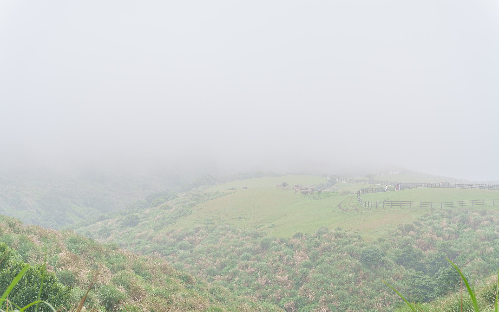
The Qingtiangang grassland (擎天崗) is a broad, rolling plateau of short turf, once a ranch and still grazed by herds of water buffalo. A circular trail around it takes under an hour, is mostly flat, and is fine for children and older walkers. On clear days it is wide-open and sunny; in cloud, the buffalo loom out of the mist like something from a film. It is also the start of longer walks, including the old path down towards Lengshuikeng and the historic trails across the mountain.
Good for: families, gentle walkers, and anyone who wants the big-sky feeling without a big climb.
Datunshan, Erziping and the flower fields
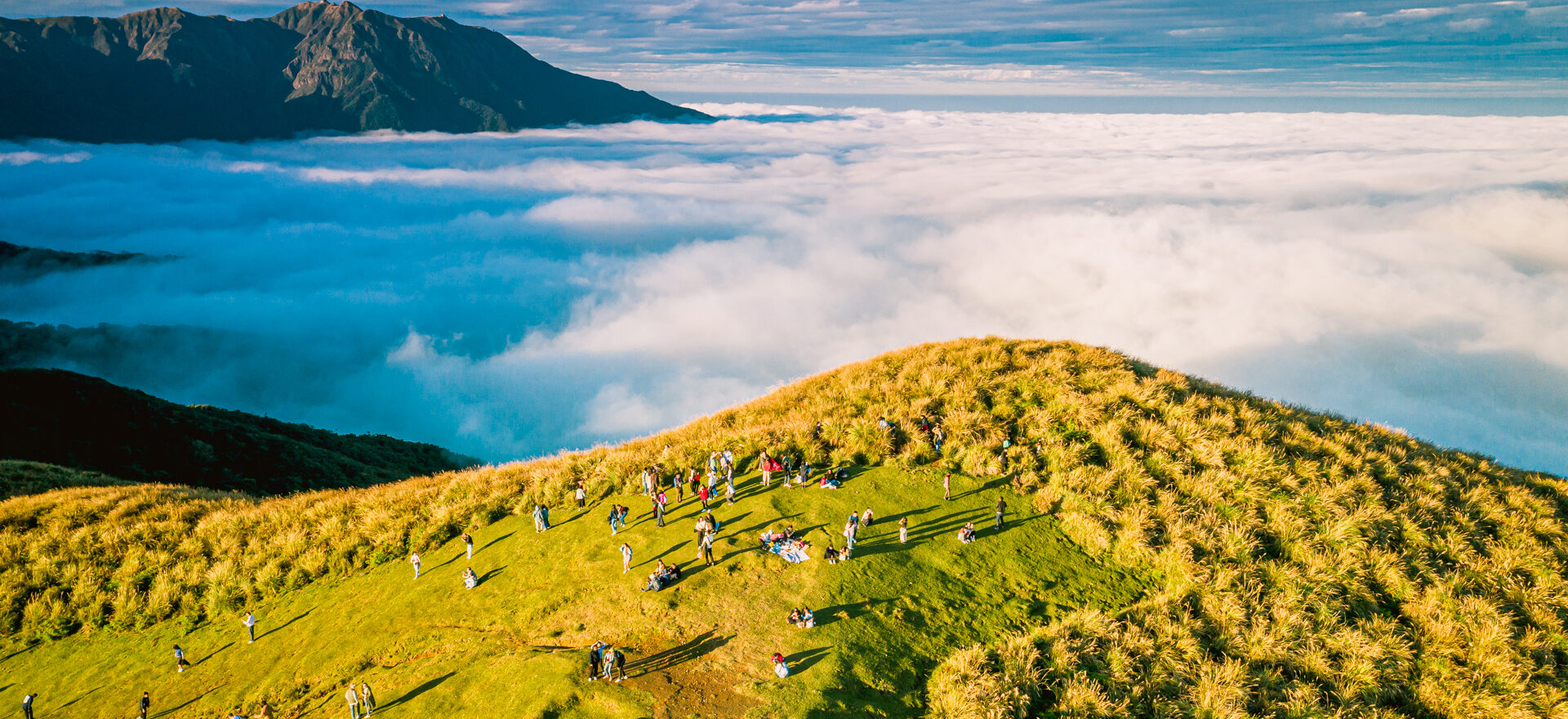
On the western side of the park, the Erziping trail is a flat, shady forest path to a pair of ponds — one of the few genuinely easy, pushchair-friendly walks in the mountains — and Datunshan, a grassy summit reached by road and a final climb, is a famous spot for sunrise and seas of cloud. Below the peaks, Zhuzihu is famous for its calla lily fields, at their best in spring, and the park fills with cherry blossoms from February into March.
Good for: easy walks, flower seasons and photography.
The north-east coast and the old gold towns
Beyond Keelung, the land rises into steep, grassy ridges above the Pacific, dotted with the remains of the gold and copper mines that made towns like Jiufen and Jinguashi rich. The hiking here is more exposed than in the city — little shade, strong wind, big views — and it pairs naturally with a day trip to Jiufen. Take a train to Ruifang and a bus up the hill, or the direct Keelung Bus 1062 from Taipei.
Teapot Mountain
Above the old mining village of Jinguashi, Teapot Mountain (茶壺山) is a rocky summit shaped, with a little imagination, like a teapot without a handle. The trail climbs from behind the Gold Museum area, past a temple with a giant statue, through open grassland to the rocks at the top, where you can scramble into the “lid”. The views take in the coast, the mining terraces and the Yin Yang Sea, where mineral-laden water stains the bay yellow. Allow a couple of hours for the round trip, and do not go up in high wind or heavy rain — the top is exposed.
Good for: combining a short, dramatic hike with Jiufen and the Gold Museum.
Our Teapot Mountain guide covers the buses to Jinguashi, the trail from Quanji Temple, the scramble at the top and a full day with Jiufen.
Keelung Mountain
Rising straight above Jiufen, Keelung Mountain (基隆山) is a steep, stepped climb to a 588-metre summit, with sweeping views over Jiufen’s rooftops, the coast and Keelung harbour. It is hot and shadeless in summer, but on a clear winter morning the view is a rewarding one.
Good for: a workout before the Jiufen crowds arrive.
The Caoling Historic Trail
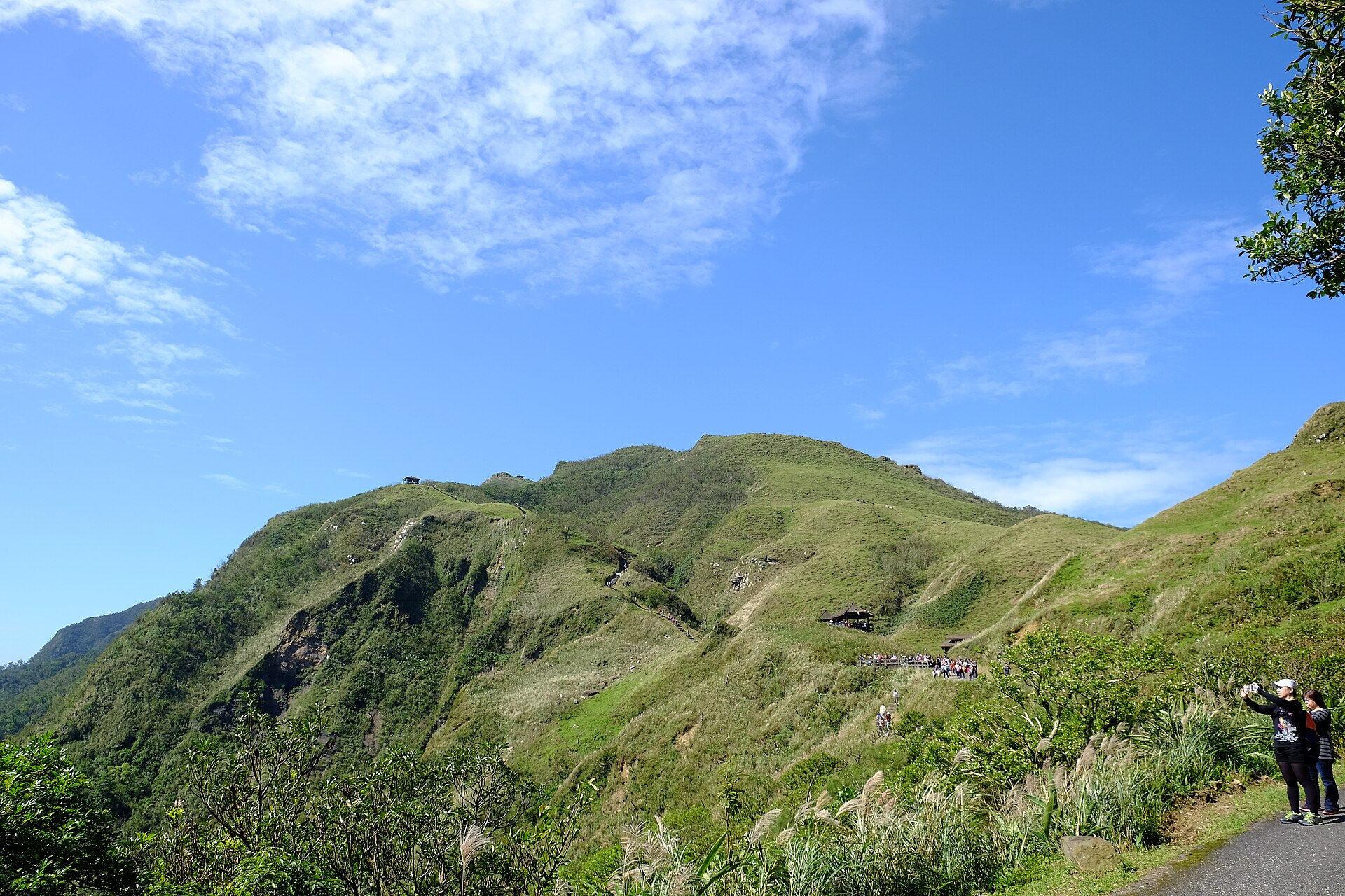
Further down the coast, the Caoling Historic Trail (草嶺古道) follows a Qing-dynasty road over the hills between Gongliao in New Taipei and Dali in Yilan. It is a proper walk, most of a day from railway station to railway station, over a windswept pass covered in silver grass that turns the hillsides a shimmering white in late autumn. On the way are stone inscriptions left by a Qing official in the 1860s, including a giant carved character for “tiger”, meant to calm the ferocious winds. The ridge views over the Pacific and Guishan Island are superb.
Good for: a full-day walk with history, sea views and a train at each end.
Waterfalls and river valleys
The hills east and south of Taipei are full of waterfalls, and several of the best can be reached by train or bus. They are at their fullest after the spring rains and in summer, when a waterfall walk is also the coolest way to spend a hot day.
The Sandiaoling Waterfall Trail
From Sandiaoling, a tiny station on the Pingxi Line one stop past Houtong, a forest trail follows a stream past three waterfalls. The city classes it as a natural hiking trail, so it takes real hiking ability, and it includes suspension bridges and close views of the upper falls. Allow two to three hours to walk it out and back, then carry on along the Pingxi Line to Shifen. It is one of the best combinations of trains and trails in northern Taiwan. Pair it with a visit to the Houtong cat village next door.
Good for: a half-day of forest and waterfalls without a car.
Our Sandiaoling Waterfall Trail guide has the trains, the three falls one by one, and the overgrown old route to Dahua station that is best avoided.
Shifen, Wulai and more waterfalls
The best-known falls are the easiest. Shifen Waterfall, a broad curtain of water within walking distance of Shifen’s lantern-launching old street, is covered in our Shifen day trip. Wulai Waterfall, a tall ribbon dropping into a forested gorge in the Atayal village of Wulai, is covered in our Wulai day trip — and Wulai has hot springs for afterwards. Around Pingxi, rocky crags such as Xiaozi Mountain (孝子山) offer short, steep climbs on steel ladders and chains for those with a head for heights.
Good for: combining a waterfall with a village day trip, especially with children.
Our guide to waterfalls near Taipei compares every fall you can reach by train or bus, including the forest falls at Neidong beyond Wulai.
Beaches and the north coast
Taipei is not a beach city, but the coast is close. North of Tamsui, the north coast curves past Baishawan, a free, quiet bay of pale sand; Cape Fugui, the northernmost point of Taiwan’s main island; and Laomei, where the rock shelf turns emerald green with algae in April and May. To the east, Fulong, about an hour and a half away by train, has three kilometres of golden sand, showers and food, and is the classic summer beach day. The 716 tourist shuttle from Tamsui MRT links the north coast sights; check the current timetable on the North Coast and Guanyinshan National Scenic Area site before you go. Our guide to the north coast covers the route in detail.
Swim only at beaches with lifeguards and flags in season. Currents along this coast are strong, typhoon swells can arrive on sunny days, and some beautiful beaches — Qixingtan near Hualien, for one — ban swimming altogether.
Good for: summer days, children, and a sunset on the way home to Tamsui.
Our guide to the beaches near Taipei compares every beach within reach, with 2026 prices for Fulong, the swimming season and water safety.
Hot springs: the Taiwanese way to finish a hike
The same volcanic heat that steams out of Xiaoyoukeng feeds some of the best hot springs in Asia, and a soak is the traditional end to a day in the hills. The main choices close to the city:
- Beitou — sulphurous springs at the foot of Yangmingshan, at the end of a short MRT branch line, with bathhouses, hotels and the Thermal Valley. Our Beitou hot springs guide covers where to bathe; note that the popular open-air public bath has been closed for renovation since early 2025, so check its status before you go.
- Wulai — clear, odourless bicarbonate springs in a river gorge south of the city, with riverside hotel baths and public bathhouses along the old street.
- Jiaoxi — a flat-land hot spring town in Yilan, about an hour and a quarter by bus, with free foot baths and a big outdoor public bath. See our Jiaoxi hot springs guide.
A few rules apply everywhere: shower thoroughly before you get in, bathe naked in single-sex public baths and in a swimsuit in mixed pools, tie up long hair or wear a cap where asked, and get out if you feel dizzy — hot water and a hard hike are a dehydrating combination.
Good for: tired legs, cold winter evenings and rainy days.
Our guide to Taipei hot springs compares every soak within reach of the city, from Beitou and Wulai to Jinshan and Su’ao’s cold spring, with costs, etiquette and recent closures.
Cycling the riverside paths
Taipei’s rivers are lined with flood walls, and behind them run long riverside parks with a continuous network of flat, well-surfaced cycle paths along the Tamsui, Keelung and Xindian rivers. They are the easiest way to see a different side of the city: rent a YouBike at an MRT station, ride through a gate in the flood wall, and follow the water to Dadaocheng Wharf, Guandu or all the way to Tamsui for sunset. Our YouBike guide explains how to rent a bike with an EasyCard. In summer, ride early or late, as there is very little shade.
Good for: a flat, easy outdoor day, and a break from the stairs.
Camping near Taipei
Camping around Taipei is mostly done at private, pay-per-pitch campsites on farms and hillsides in the surrounding mountains, many with toilets, showers and pre-pitched glamping tents, and a car is usually needed to reach them. Wild camping is restricted in national parks and generally discouraged elsewhere. For most short-stay visitors, a night in a hot spring hotel in Wulai or Jiaoxi is an easier way to wake up in the hills.
Good for: longer stays with a car, and families who want a night outdoors.
When to go hiking in Taipei
| Season | What to expect | Best for |
|---|---|---|
| October–December | Drier, clearer and cooler; the best views of the year. The north-east coast and Yangmingshan get more cloud and wind as winter sets in | Everything, especially summits and the Caoling silver grass |
| January–February | Cool and often damp, with drizzle and fog on the peaks, but also crisp clear days between fronts | City hikes, hot springs, cherry blossoms from February |
| March–April | Warming up, green and flowery, with changeable weather | Yangmingshan flowers, waterfalls, Laomei’s green reef |
| May–June | The plum rains: frequent, heavy showers and humid heat | Waterfalls at full flow; short hikes between showers |
| July–September | Hot, humid, afternoon thunderstorms and typhoon season | Dawn hikes, beaches, riverside cycling at dusk |
Our guides to the best time to visit Taipei and to Taipei in autumn go into more detail. For forecasts, warnings and mountain weather, the source of record is Taiwan’s Central Weather Administration.
Staying safe on Taipei’s trails
Taipei’s trails are well built and well used, and the biggest risks are the weather and your own enthusiasm rather than the terrain. The things that actually cause trouble:
- Heat and humidity. From June to September, a two-hour climb in the midday sun is genuinely dangerous. Start by 07:00, carry more water than you think you need — at least a litre for a short hike, much more for a long one — and turn back if you feel dizzy or stop sweating.
- Rain and typhoons. Summer thunderstorms build quickly in the afternoons, and wet stone steps and rock are slippery. During typhoon warnings, stay off the trails altogether: mountain roads close, landslides happen, and rescues put others at risk. See our guide to typhoon season.
- Fog and wind on the peaks. Yangmingshan and the north-east coast can go from sunshine to thick cloud in minutes. On open grassland in fog, stay on the marked path.
- Wildlife. Formosan macaques on some trails will snatch food; do not feed them. Snakes, including venomous vipers, live in the forest — stay on the path, do not reach into undergrowth, and watch where you step. Wasps and hornets are most active in autumn; do not linger near a nest, and move away quickly if they start to buzz around you. Stray dogs occasionally guard quiet trails; a walking pole and a calm retreat are usually enough.
- Navigation. Main trails are signposted, but junctions on quieter routes are not always clear. Download an offline map or a Taiwanese hiking app with trail tracks before you go.
- Emergencies. Dial 119 for rescue and ambulance and 110 for the police. Mobile coverage is good on most trails near the city. Tell someone your plan if you are walking alone on a longer route.
What to bring
- Shoes with grip. Trainers are fine for city trails; boots or trail shoes help on Qixing, Jinmian, Teapot Mountain and anything wet or rocky.
- Water and salty snacks. Convenience stores near trailheads sell both; the trails themselves usually do not.
- An umbrella. Locals carry one for sun as much as rain, and it is often more practical than a jacket in the heat.
- A light layer. The peaks are cooler and windier than the city.
- Insect repellent and sun cream. Mosquitoes are a year-round presence in the forest.
- A head torch if you are hiking for sunset.
- A small bag for rubbish. Bins are rare on trails, and across Taiwan in general.
- An EasyCard with credit on it for buses, trains and taxis at the end of the day.
Our Taipei packing list covers clothing for each season.
Getting to the trailheads
Almost every hike in this guide can be reached by public transport, and one EasyCard covers the lot. The MRT reaches Elephant Mountain, Jiantan, Neihu, Maokong (via the gondola from Taipei Zoo) and Beitou. City buses climb to Yangmingshan, Tianmu and Wulai; our Taipei bus guide explains how to use them. Taiwan Railways local trains run to Ruifang for Jiufen and Teapot Mountain, along the Pingxi Line for Sandiaoling and Shifen, and down the coast to Fulong and the Caoling trail. For the north coast, the 716 shuttle runs from Tamsui MRT.
Weekend buses to popular trailheads fill up, especially in flower season, and the last buses down from the mountains can be earlier than you expect. Check the return timetable before you set off, and keep a taxi or ride-hailing app as a fallback.
Trail etiquette
- Carry your rubbish out. Taiwan has few public bins, and hikers are expected to take everything home.
- Stay on the path. Especially in the national park, where the grasslands and flowers are protected.
- Be courteous at shrines. Small temples and shrines line many trails; walk round rather than through anyone praying, and do not climb on altars for photos.
- Keep the noise down. Speakers playing music are common on Taiwanese trails, but most hikers appreciate quiet.
- Say hello. A nod or a greeting to other hikers is normal, and early-morning regulars on city trails are often happy to point the way.
Hiking with children
Taipei is a very good city for outdoor days with children, as long as you pick the right trails. The Qingtiangang loop and the Erziping trail in Yangmingshan are flat and short; Maokong’s gondola is an adventure in itself; the first section of the Sandiaoling trail is easy; and beaches and riverside cycling need no hiking at all. Elephant Mountain is short but steep, and fine for determined older children. Leave Jinmian, Teapot Mountain and the full Sandiaoling trail to teenagers and adults. Our Taipei with kids guide has more ideas.
A week of outdoor days
If you are staying a week and love the outdoors, this plan gives you one outdoor adventure a day without ever needing a car:
- Day 1 — The city ridges. The Four Beasts in the afternoon, finishing on Elephant Mountain for sunset.
- Day 2 — Yangmingshan. Bus R5 up, Qixing Mountain from Xiaoyoukeng, the Qingtiangang loop, then down to Beitou for a soak.
- Day 3 — The Pingxi Line. The Sandiaoling waterfall trail in the morning, Houtong’s cats, and Shifen in the afternoon.
- Day 4 — The gold towns. Teapot Mountain early, the Gold Museum, and Jiufen as the lanterns come on.
- Day 5 — The north coast. The 716 shuttle from Tamsui to Baishawan, Cape Fugui and the Juming Museum, back to Tamsui for sunset.
- Day 6 — Wulai. The waterfall, the village and an evening hot spring.
- Day 7 — An easy day. YouBike along the riverside paths, or the gondola to Maokong for tea.
In late autumn, swap Day 5 for the Caoling Historic Trail; in summer, swap the long hikes for beaches and waterfalls and do everything before 10:00. For more ideas beyond hiking, see our guide to day trips from Taipei.
What we would skip
- Taroko Gorge as a hiking day trip. The gorge is still recovering from the April 2024 earthquake and later typhoons; the Swallow Grotto Trail remains closed, and it is a long way from Taipei. Check the access notices on the national park’s website and read our Taroko Gorge guide before you plan anything.
- Midday summits in July and August. Heat exhaustion is the most common way a Taipei hike goes wrong. Go at dawn or not at all.
- Qixing Mountain in thick cloud. You will climb for two hours to see white. On a grey day, walk Qingtiangang or soak in Beitou instead.
- Elephant Mountain at sunset on a holiday weekend if you dislike crowds. Walk the Four Beasts or climb Jiantan Mountain for a quieter view.
- Paying for a guided tour of a trail you can reach by MRT. For city hikes and Yangmingshan, public transport and a good map are all you need. Save guides for long routes, river tracing and anything technical.
- Any trail during a typhoon warning, however calm it looks outside your hotel window.
Related Taipei guides
- Elephant Mountain Hike
- Yangmingshan National Park
- Yangmingshan Day Trip
- Maokong Gondola Guide
- Neihu: Lakeside Parks, Ridge Hikes and a Ferris Wheel
- Tianmu Guide
- Jiufen Day Trip
- Shifen Day Trip
- Wulai Day Trip
- Taiwan’s North Coast
- Beitou Hot Springs Guide
- Jiaoxi Hot Springs
- Day Trips from Taipei
- Taipei Typhoon Season
Frequently Asked Questions
What is the best hike in Taipei?
For a first visit, Elephant Mountain gives the famous view of Taipei 101 for about half an hour of steep steps. For a longer city walk, the Four Beasts ridge is the best reward for the effort. For a real mountain, climb Qixing Mountain in Yangmingshan, Taipei’s highest peak at 1,120 metres.
Can you go hiking in Taipei without a car?
Yes. Almost every popular hike near Taipei starts at or near an MRT station, a city bus stop or a local railway station, and one EasyCard covers all of them. Buses R5 and 260 reach Yangmingshan, local trains reach the Pingxi Line and the north-east coast, and the 716 shuttle serves the north coast.
What is the easiest hike in Taipei?
The Qingtiangang circular trail in Yangmingshan takes under an hour and is mostly flat, and the Erziping trail is a flat forest path suitable for pushchairs. In the city, Maokong’s tea trails are gentle, and Elephant Mountain is short, though steep.
What is the highest mountain in Taipei?
Qixing Mountain (Seven Star Mountain) in Yangmingshan National Park, at 1,120 metres. The shortest route starts at the Xiaoyoukeng fumaroles; a return trip from Lengshuikeng takes about two and a half to three hours.
When is the best time for hiking in Taipei?
October to December is the best season, with clearer skies, cooler temperatures and drier trails. March and April are also good. From June to September, hike only at dawn because of the heat, and avoid the trails entirely during typhoon warnings.
Is it safe to hike alone in Taipei?
On popular trails near the city, yes: they are busy, well signposted and have mobile coverage. On longer or quieter routes, tell someone your plan, carry plenty of water, download an offline map and turn back if the weather changes. Dial 119 in an emergency.
Do I need hiking boots in Taipei?
Not for most city trails, which are stone staircases; trainers with good grip are fine. Boots or trail shoes help on rocky or muddy routes such as Jinmian Mountain, Teapot Mountain, the upper Sandiaoling trail and Qixing Mountain in wet weather.
Are there snakes on Taipei’s hiking trails?
Yes, including venomous species, but bites on busy trails are rare. Stay on the path, do not reach into undergrowth or rock crevices, and watch where you step, especially in warm, damp weather. If someone is bitten, keep them still and call 119.
How do I get to Yangmingshan by bus?
Take bus R5 (紅5) from Jiantan station on the Red Line, or bus 260 from the Taipei Main Station area, to the Yangmingshan bus terminal. The 108 loop bus then links the main trailheads inside the park.
Can you swim at the beaches near Taipei?
Yes, in summer, at beaches with lifeguards such as Fulong and Baishawan. Swim only where there are lifeguards and flags, as currents along the coast are strong, and stay out of the water when typhoons are offshore, even on sunny days.
Where can I soak in a hot spring after a hike?
Beitou, at the foot of Yangmingshan and on the MRT, is the natural choice after a mountain day. Wulai pairs with its waterfall, and Jiaoxi in Yilan has free foot baths and a big outdoor public bath. Check whether Beitou’s open-air public bath has reopened after its renovation before you go.
What is the Taipei Grand Trail?
A long-distance hiking route laid out by the Taipei City Government around the hills of the basin: about 92 kilometres in seven mountain sections, from Guandu MRT station over Yangmingshan and the eastern ridges to Maokong, plus a riverside section that makes the full route about 130 kilometres. Most sections start and end near public transport.
Can I hike in Taipei in summer?
Yes, but start early. From June to September, begin by 07:00, finish before the midday heat, carry plenty of water and watch for afternoon thunderstorms. Waterfall trails, beaches and riverside cycling are better summer choices than exposed summits.
The Bottom Line
Few big cities put this much wild country within reach of a metro card. In Taipei you can climb to the classic skyline view in twenty minutes, walk a ridge of four small mountains in an afternoon, stand on a steaming volcano and a buffalo-grazed grassland in a morning, follow a stream past three waterfalls from a country railway halt, and look down on the Pacific from a gold miners’ mountain — and finish every one of those days in a hot spring or a night market. Go in autumn if you can, start early whatever the season, respect the heat and the typhoons, and skip the famous day trips that are more bus than trail. The best of hiking in Taipei is closer than you think.
Photo Credits
A sea of clouds from a summit in Yangmingshan National Park: YangmingshanNP MenHuanChao 001 by Men-Huan Chao, CC BY-SA 4.0, via Wikimedia Commons.
Water buffalo on the Qingtiangang grassland in fog: 202506 早晨起霧的擎天崗草原 01 by Junyu-K, CC BY 4.0, via Wikimedia Commons.
The Caoling Historic Trail: 2016 Caoling Historic Trail Toucheng Segment by Taiwankengo, CC BY-SA 4.0, via Wikimedia Commons.