This article contains advertising. Our booking links are routed through a partner that adds commission tracking automatically, so if you book through one we earn a commission from the provider, at no extra cost to you. It never affects what we recommend. Affiliate disclosure
Everywhere else in Taiwan, a hire car is more trouble than it is worth: the trains are excellent, the cities are gridlocked and parking is a sport. The east coast is the exception. Between Hualien and Taitung, two roads run roughly parallel for about 170 kilometres — Highway 11 along the Pacific, Highway 9 up a green rift valley between two mountain ranges — and the best things on this side of the island sit on those roads rather than at the railway stations. Put the two together and you have a natural loop, which is why a Taiwan east coast road trip is the one self-drive holiday on the island that makes complete sense. The trick, perhaps surprisingly, is not to start it by driving out of Taipei.
This guide covers how to get to the start, what the Suhua Highway is like in 2026, the coast road and the valley road stop by stop, a five-day loop with shorter and longer versions, costs, driving rules, and when to go. Prices were checked in September 2026; treat them as the right order of magnitude and confirm before you book.
The road trip at a glance
| What | Cost or detail |
|---|---|
| Train, Taipei → Hualien (express) | NT$583 · about 2¼ hours · book 28 days ahead |
| Car hire in Hualien, small car | Roughly NT$1,500–2,000 a day through the big comparison sites; cheaper deals exist |
| One-way drop-off in Taitung | Typically NT$2,000–5,000 on top |
| Train, Taitung → Taipei (express) | NT$936 · about 3½–5 hours |
| Hualien to Taitung | About 170 km by either road — three hours’ driving without stops |
| Documents | Passport, home licence and an International Driving Permit |
| Time needed | Four days minimum; five or six is right |
| Best months | October–April for weather; August–October for the daylilies |
Don’t start in Taipei: take the train to Hualien
You can drive from Taipei to Hualien. Freeway 5 through the Hsuehshan Tunnel gets you to Yilan in an hour, and from Su’ao the Suhua Highway runs south along the cliffs to Hualien. For years that road was one of the great drives in Asia. In 2026 it is mostly a long construction zone, and not one we would choose to start a holiday on.
- The April 2024 earthquake did severe damage along the highway, particularly on its southern Xiulin section, which is now the most unstable stretch.
- In April 2026 a rockslide hit the Daqingshui shelter tunnel; it reopened within hours to alternating single-lane traffic, and reconstruction there brought single-lane control through much of the spring.
- The old coastal road below the cliffs — Highway 9D between Daqingshui and Heren — was abandoned in January 2026. All traffic now uses the main road’s tunnels, so the famous cliff-edge views are largely gone from the driver’s seat.
- A NT$105.6 billion renovation approved in August 2025 runs to 2032. Expect roadworks, convoy-style delays and heavy trucks for years.
Compare that with the train: about two and a quarter hours on a Puyuma or Taroko express for NT$583, with glimpses of the Pacific out of the left-hand window as you near Hualien. Collect a hire car near Hualien Station, drive the loop, and either drop the car in Taitung and take the train home, or loop back to Hualien. The one catch is that east coast express seats sell out, especially at weekends — Taiwan Railways opens reservations 28 days ahead, and you should book the morning the window opens. Our guides to Taipei to Hualien and Taiwan train travel cover the booking in detail.
If you do decide to drive the Suhua, check the Highway Bureau’s road information the day before, travel in daylight, allow three to four hours from Su’ao, and turn back rather than push on if heavy rain is forecast.
The shape of the loop
Think of it as a ladder. The two long sides are the coast road and the valley road; the rungs are a handful of cross-roads over the low Coastal Mountain Range between them.
- Highway 11, the coast road — Hualien south through Jici, Shitiping, Jingpu, Baxian Caves, Sanxiantai, Chenggong and Dulan to Taitung. Ocean on one side, mountains straight up on the other, and Amis villages in between.
- Highway 9, the valley road — Taitung north through Luye, Guanshan, Chishang, Fuli, Yuli, Ruisui and Guangfu back to Hualien. Rice paddies, hot springs, and the Central Mountain Range filling the western sky.
- The rungs — the road along the Xiuguluan River from Ruisui to the coast at Jingpu; Highway 30 from Yuli over to Changbin; and Highway 23 from Fuli to Donghe. These let you cut the loop short or zigzag between the two sides.
Driving either side without stopping takes around three hours. That is exactly why this is a trip of days rather than hours: the point is the stopping.
Highway 11: the coast road
Heading south from Hualien, the road leaves the city behind within twenty minutes and does not really meet another town of any size until Chenggong, a hundred-odd kilometres on. The stops below are in driving order.
Jici Bay
A crescent of sand below the mountains and one of the few places on this coast with a managed swimming beach in summer. Almost everywhere else, the currents make swimming a bad idea — obey the signs.
Shitiping
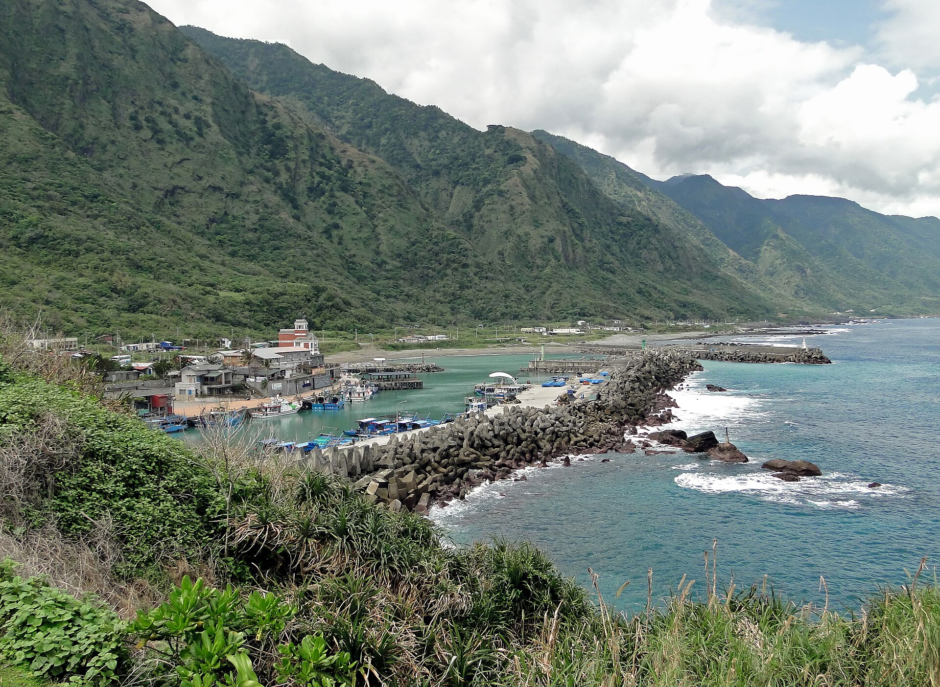
The name means “stone ladder”, after the terraces of pale volcanic rock that step down into the sea here, full of tide pools at low water. There is a campsite on the headland, a small fishing harbour, and whale- and dolphin-watching boats in season. Give it an hour, longer if the tide is out.
Jingpu and the Tropic of Cancer
At the mouth of the Xiuguluan River, the red arch of the Changhong Bridge carries the highway over the water, and nearby a white marker shows where the Tropic of Cancer crosses the coast. It is a photo stop rather than a destination. Jingpu is also where the river road from Ruisui meets the coast, so it is the natural place to cut across if you are short of time.
Baxian Caves
A cliff pocked with sea caves that are now high above the waves, lifted there by the same tectonic squeeze that built the mountains. The caves are one of Taiwan’s most important prehistoric sites, and several hold small shrines. Stairs and paths climb between them; allow an hour and wear decent shoes.
Sanxiantai
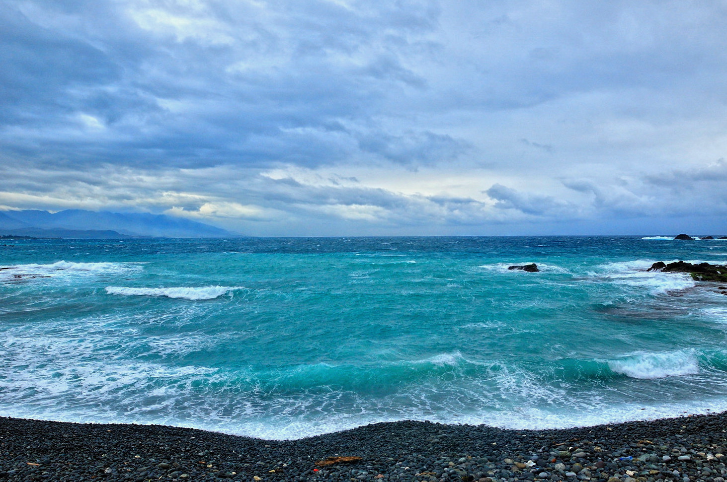
The coast road’s signature stop. Three rocky humps — the “three immortals” of the name — stand on a small islet just offshore, joined to the mainland by a long footbridge whose eight arches rise and fall like the back of a sea dragon. Walking across and round the islet takes about an hour, and at sunrise, with the light coming straight up out of the Pacific, it is one of the best hours on the whole trip. Stay somewhere nearby the night before and get there early; by mid-morning the tour coaches arrive.
Chenggong, Donghe and Jinzun
Chenggong is the main fishing port on this stretch of coast and the place to eat whatever came in that day. A little further south, Donghe is known across Taiwan for its steamed buns — there is usually a queue — and Jinzun has a viewpoint over a long beach and a sea stack, with surfers in the water below when the swell is up.
Dulan
An Amis village that became the east coast’s artistic and surfing outpost. The old Dulan Sugar Factory is now a loose collection of studios, a café and a venue with live music most weekends, and the village has a scattering of guesthouses, surf-board rental and good small restaurants. It is the most relaxed place on the whole loop to spend a night, and it is where many people end up spending two.
Into Taitung
The last stretch passes Jialulan, a seaside lawn scattered with driftwood sculptures, and Xiaoyeliu, a strip of oddly eroded sandstone by Fugang harbour, where the ferries leave for Green Island and Orchid Island. Taitung City is small, laid-back and well set up for an overnight: the Tiehua Village music venue for an evening, the forest park and seafront by day, and the hot spring resort of Zhiben half an hour south if you want a soak.
Highway 9: the rift valley
Driving north from Taitung, the landscape changes completely. The road runs up the East Rift Valley, a long, flat corridor of rice paddies squeezed between the Coastal Range and the much higher Central Mountain Range, with small farming towns every twenty or thirty kilometres.
Luye Highland
A grassy plateau above the valley that serves as a paragliding launch and, every summer, the home of the Taiwan International Balloon Festival. In 2026 it ran from 4 July to 20 August, closed on Tuesdays, with balloons going up at about 05:30 and “night glow” concerts in the evenings; check the Tourism Administration’s event page for each year’s dates. Outside the festival it is a pleasant, breezy viewpoint and not much more.
Chishang
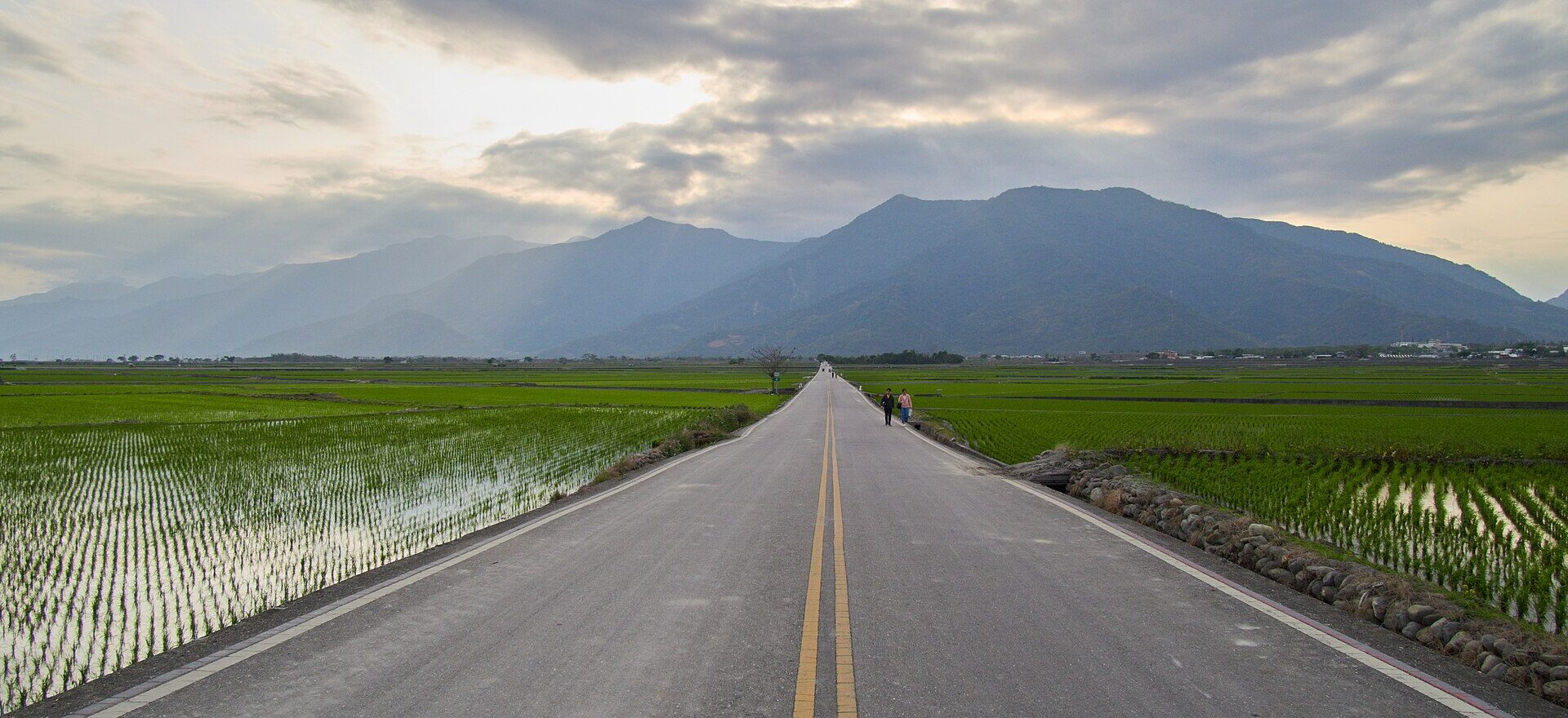
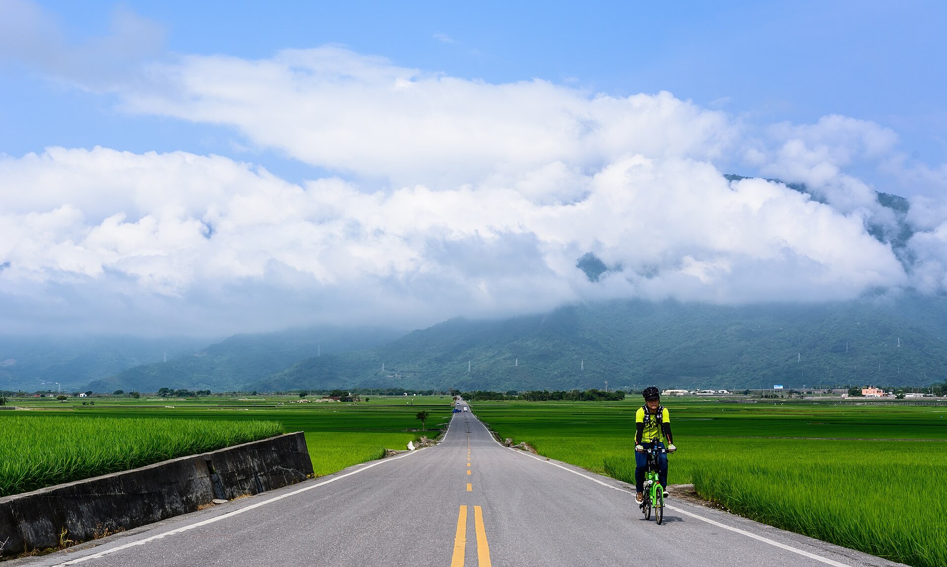
The valley’s best-known town, famous across Taiwan for its rice and its lunchboxes. The reason visitors come is the paddies: a network of farm roads crossing a perfectly flat plain of rice with the mountains at the end of every view. The most photographed is Mr. Brown Avenue, named after the coffee advertisement filmed on it, and nearby stands the lone tree made famous by an airline commercial with the actor Takeshi Kaneshiro. Both are more enjoyable than their fame suggests, provided you arrive early and on a bike. Bike hire is easy to find in town; the car can stay parked for the afternoon.
The paddies are green through spring and summer and turn gold before the two harvests, around early summer and again in autumn.
Fuli and Yuli: the daylily mountains
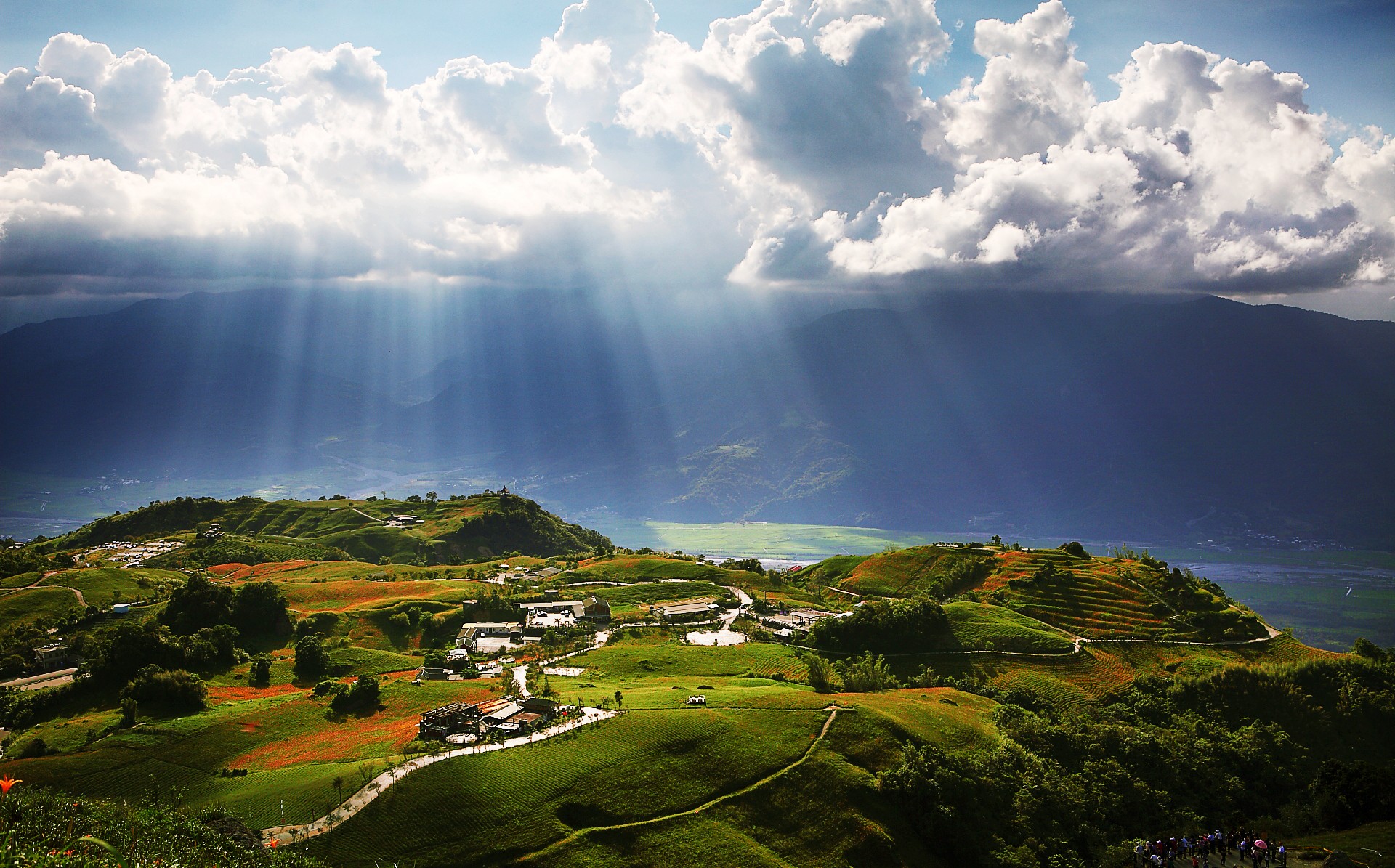
From about August to mid-October, the hillsides of Liushidan Mountain above Fuli and Chike Mountain above Yuli turn orange with daylilies, grown here as a crop for their edible buds. Both are reached by steep, narrow mountain roads with limited parking; go on a weekday, early, and expect to walk the last stretch at weekends. The East Rift Valley National Scenic Area posts bloom updates each season. Down in Yuli, stop for a bowl of the town’s noodles.
Ruisui and Guangfu
Ruisui has hot springs with iron-rich, rust-coloured water, a dairy ranch, and rafting on the Xiuguluan River in the warmer months — the river cuts through the Coastal Range to the sea at Jingpu, and the road alongside it is one of the loop’s rungs. Further north, Guangfu has the Mataian wetland, an Amis farming landscape of ponds and fish traps, and a former sugar factory that sells ice cream to everyone driving past. From there it is under an hour back to Hualien.
A five-day loop
This is the version we would do: train in, loop south by the coast, north by the valley, and train home from where you started.
| Day | Route | Overnight |
|---|---|---|
| 1 | Morning train from Taipei. Collect the car in Hualien. Afternoon at Qixingtan or a sea kayak under the Qingshui Cliffs. | Hualien City |
| 2 | Highway 11 south: Jici, Shitiping, Jingpu and the Tropic of Cancer marker, Baxian Caves. | Near Sanxiantai or Chenggong |
| 3 | Sunrise at Sanxiantai. Chenggong harbour, Donghe buns, Jinzun, Dulan. | Dulan |
| 4 | Jialulan and Taitung, then north up Highway 9: Luye Highland, afternoon on a bike in Chishang. | Chishang |
| 5 | Liushidan or Chike in season, Ruisui, Guangfu. Drop the car in Hualien; evening train to Taipei. | — |
Shorter and longer versions
- Four days: skip Taitung. Drive the coast as far as Chenggong or Dulan, then cross the Coastal Range by Highway 30 or Highway 23 to the valley and head north. You lose Taitung City and little else.
- Six days: add a second night in Dulan and a slower day in the valley, with a hot spring at Ruisui.
- A week or more: add Green Island by ferry from Fugang, or drop the car in Taitung, take the train round the southern end of the island to Kaohsiung and come back up the west coast on the high speed rail. Our 10-day Taiwan itinerary works this into a full circuit.
The villages along the way
Much of this coast and valley is Indigenous land, home above all to the Amis, Taiwan’s largest Indigenous people, with Bunun, Puyuma and other communities inland and to the south. It is a different Taiwan from the Han-majority west — different food, languages, music and church spires in the villages — and it is one of the reasons the east coast feels so unlike the rest of the island. Our guide to how Taiwan differs from China touches on why that matters.
In July and August many villages hold their harvest festivals. Some welcome visitors warmly; parts of others are private ceremonies, not performances. The rules of thumb are the obvious ones: ask before photographing people, follow the lead of whoever invited you, do not wander into ritual spaces, and buy food and crafts from the village stalls rather than the coach-party souvenir shops on the highway.
Adding Green Island or Orchid Island
From Fugang harbour, just north of Taitung City, ferries cross to Green Island, a small volcanic island with a coastal ring road, very good snorkelling, a rare saltwater hot spring by the shore, and a sobering memorial park on the site of its former political prison. Orchid Island, further out, is home to the Tao people and is wilder and more remote again.
Both are summer destinations. The crossing to Green Island takes under an hour and is notorious for seasickness; in winter, when the north-east monsoon is blowing, sailings are frequently cancelled. If you want to add an island, allow two nights on top of the loop, book the ferry and a room together, and keep a spare day in case the boat does not run. Leave the car on the mainland; scooters and e-bikes are how everyone gets around the islands, subject to the same licence caveat as everywhere else.
What it costs
For two people on the five-day loop above, the fixed costs look like this:
| Item | Approximate cost |
|---|---|
| Trains, Taipei ↔ Hualien, two people | NT$2,332 (4 × NT$583) |
| Small hire car, four days | NT$6,000–8,000 |
| Fuel, parking, tolls | Modest — a tank or two for the loop |
| Guesthouses, four nights | Varies hugely with season and weekend demand |
Dropping the car in Taitung instead adds a one-way fee, typically NT$2,000–5,000, and swaps the return train for the Taitung express at NT$936 each. It saves you a day’s backtracking up the valley, so it is worth pricing both. Car hire rates move with the season; compare the international comparison sites with the local rental firms clustered around Hualien Station.
Driving on the east coast
- You need an International Driving Permit alongside your home licence and passport, or the rental desk will turn you away. See our car rental guide for the details.
- Traffic drives on the right. Scooters filter up both sides at junctions; expect them everywhere and give them room.
- Speed cameras are everywhere, including on empty rural stretches of Highway 11, and fines follow you to the rental company.
- Highway 11 is a two-lane road shared with tour coaches, gravel trucks and cyclists doing the round-island ride. Overtake with patience.
- Avoid driving after dark outside the towns: the roads are unlit, and farm vehicles, dogs and the occasional landslip appear without warning.
- After heavy rain, check for rockfall on the mountain roads to Liushidan and Chike and on the cross-roads over the Coastal Range.
- Scooters are the cheapest way round and the shops will happily rent you one, but most visitors do not hold the licence category that covers them, which leaves you uninsured. A car or an e-bike is the honest option.
- Mobile coverage thins in the valleys and along empty stretches of coast. Download offline maps and consider a Chunghwa SIM — see SIM cards and eSIMs.
Can you do it without a car?
Half of it, comfortably. The valley is on the Taiwan Railways line — Chishang, Guanshan, Yuli and Ruisui all have stations — and with a hired bike at each stop it makes a lovely slow trip by train. The coast road is harder: local buses from Hualien and Taitung run along Highway 11, but only a handful of times a day, and fitting Shitiping, Baxian Caves and Sanxiantai around them takes patience and luck. Hiring a driver for a day or two is the middle way, and small local operators in Hualien and Taitung offer exactly that.
When to go
October to April is the settled season on the east coast: warm, mostly clear, and past the typhoons. It is noticeably drier and sunnier than the north-east in winter, and a good escape from Taipei’s grey months.
Summer brings heat, humidity and the typhoon season from July to September, when storms often make landfall on this coast first and close roads and railways at short notice — watch the Central Weather Administration and read our typhoon guide. It also brings the balloon festival at Luye, the Amis harvest festivals in the coastal villages, and, from August, the daylilies. If you go then, build a spare day into the plan.
Weekends and holidays are busy everywhere on the loop, and the trains back to Taipei on Sunday afternoons are the first thing to sell out. Travel midweek if you possibly can.
Where to stay
The loop is guesthouse country. Family-run minsu (民宿) are the norm outside Hualien and Taitung cities, and the good ones — a sea view in Dulan, a farmhouse among the paddies in Chishang — are the best part of the trip. They are also small and few, and they fill at weekends, so book the nights you care about first. Hualien and Taitung have the only real hotel choice; the hot spring areas at Ruisui and Zhiben have resort hotels if you want a pool and a soak.
What we would skip
Driving the Suhua Highway from Taipei in 2026. Hours of tunnels, single-lane controls and trucks, and the cliff views that made it famous are mostly bypassed now. Take the train and rent in Hualien.
Doing the loop in two days. It can be driven that fast, and you would see the coast from behind a tour coach. Four days is the minimum that feels like a holiday.
Planning the trip around Taroko Gorge. The gorge is still heavily restricted after the 2024 earthquake — see our Taroko guide for its current status — and the loop south of Hualien is better anyway.
The famous-tree queue at midday. The Chishang tree is a tree. Cycle past it early, then enjoy the thirty kilometres of paddies around it that nobody queues for.
Driving at night. Nothing on this coast is worth an unlit mountain road in the dark.
Related Taipei guides
- Taiwan Beyond Taipei: Where to Go Next
- Taipei to Hualien: Train, Bus or Flight
- Taiwan Train Travel: HSR vs TRA vs Bus
- Car Rental in Taiwan
- Taroko Gorge from Taipei
- Taiwan Itinerary: 10 Days from Taipei
- Yilan from Taipei
- Taipei Typhoon Season
- Taiwan SIM Cards and eSIMs
- The Best Time to Visit Taiwan
Frequently Asked Questions
How many days do you need for a Taiwan east coast road trip?
Four days is the minimum for the Hualien–Taitung loop, and five or six is better. The driving itself is only about three hours each way; the time goes on the stops — Shitiping, Baxian Caves, Sanxiantai at sunrise, a night in Dulan, an afternoon on a bike in Chishang.
Should I drive from Taipei to Hualien?
In 2026, we would not. The Suhua Highway is a long construction zone after the 2024 earthquake, with single-lane controls and a renovation programme running to 2032. The express train takes about two and a quarter hours for NT$583, and you can hire a car near Hualien Station.
Is the Suhua Highway open?
Yes, but with frequent roadworks and occasional single-lane control, most recently after a rockslide at the Daqingshui tunnel in April 2026. The old cliff road below it, Highway 9D between Daqingshui and Heren, has been abandoned. Check the Highway Bureau’s road information before you drive it.
Do I need an International Driving Permit in Taiwan?
Yes. Rental companies require your passport, your home driving licence and an International Driving Permit. Without the permit you will not be given a car.
Which is better, Highway 11 or Highway 9?
Do both — that is the point of the loop. Highway 11 is the coast road, with the ocean, Shitiping, Baxian Caves and Sanxiantai. Highway 9 is the rift valley, with rice paddies, Chishang, the daylily mountains and hot springs. Go south on one and north on the other.
How much does it cost to rent a car in Hualien?
Roughly NT$1,500–2,000 a day for a small car through the big comparison sites, with cheaper deals from local firms. Returning the car in Taitung instead of Hualien usually adds a one-way fee of around NT$2,000–5,000.
Is Sanxiantai worth it?
Yes — it is the best single stop on Highway 11. Go at sunrise, when the light comes straight off the Pacific and the coaches have not arrived, and allow an hour to cross the eight-arched footbridge and walk round the islet.
When do the daylilies bloom at Liushidan Mountain?
From about August to mid-October, on Liushidan Mountain above Fuli and Chike Mountain above Yuli. The roads up are steep and narrow with little parking, so go early and on a weekday.
When is the Taitung balloon festival?
Every summer at Luye Highland. In 2026 it ran from 4 July to 20 August, closed on Tuesdays, with balloons going up around 05:30 and night-glow concerts in the evenings. Check each year’s dates before planning around it.
Can you do the east coast without a car?
Partly. The rift valley towns are on the railway, and trains plus hired bikes work well there. The coast road has only a few local buses a day, so for Highway 11 a car, or a hired driver for a day, makes life much easier.
Is it safe to drive on Taiwan’s east coast?
Yes, with care. Roads are good and well signposted in English. Watch for scooters, tour coaches and speed cameras, avoid mountain roads after heavy rain, and do not drive outside the towns after dark.
When is the best time for an east coast road trip?
October to April, when it is warm, mostly clear and outside the typhoon season. Summer brings festivals and the daylilies but also typhoons, which can close roads at short notice — leave a spare day if you go between July and September.
Can I combine the east coast with the rest of Taiwan?
Yes. Drop the car in Taitung, take the train round the southern end of the island to Kaohsiung, and come back up the west coast on the high speed rail, stopping in Tainan and Taichung on the way.
The Bottom Line
Take the train to Hualien, pick up a car, and give the loop five days: south down Highway 11 with the Pacific on your left, a sunrise at Sanxiantai, a night or two in Dulan, then north up the rift valley through Chishang’s paddies and — if it is late summer — the orange hillsides of Liushidan. Leave the Suhua Highway to the engineers for now.
It is the one trip in Taiwan where a car genuinely earns its keep, and the one where the slow, wandering, stop-whenever-you-like version is so obviously better than the efficient one. Book the train the day the window opens, book the guesthouses you care about next, and leave the rest to the road.
Photo Credits
Mr. Brown Avenue, Chishang: Mr. Brown Avenue, Chishang by lumoplank, CC0, via Wikimedia Commons.
Shitiping harbour: Shihtiping Harbor 01 by Bernard Gagnon, CC BY-SA 3.0, via Wikimedia Commons.
The sea at Sanxiantai: Clouds over beautiful blue sea at Sanxiantai on 4 February 2014 by lwtt93, CC BY 2.0, via Wikimedia Commons.
Liushidan Mountain in daylily season (cropped): 花蓮 六十石山 Liushidan Mountain, Hualien county, Taiwan by Jerry Lai from Hsinchu, Taiwan, CC BY-SA 2.0, via Wikimedia Commons.
A cyclist near Chishang (cropped): The Brown Boulevard Chishang Taitung by 大雄 汪, CC BY-SA 2.0, via Wikimedia Commons.